Showing posts with label bicycle lanes. Show all posts

Tuesday, May 5, 2015

Cycle lane life-cycle cost


I was walking through the city and noticed this advanced stop line for cyclists. Although it is great to see the facility, the standard of maintenance is rather poor. It got me thinking about the longevity of the pavement markings used for cycle lanes. A cycle lane treatment recently installed close to my home didn't last much more than a month before the buses turning over it ripped off massive chunks of the green painted lane. As can be seen in the picture above, the wear from traffic has inflicted far more damage to the green cycle lane than to the white edge lines. 

Austroads undertook a study of Australian practice in cycle lane marking which is rather inconclusive about the longevity and lifecycle cost of cycle lane treatments. From what I have noticed the Gold Coasts thermoplastic cycle lane treatment (see the picture below) which is heated and melted into the asphalt. This is best done when the road is resurfaced. Painted cycle lanes have lifespans up to two years (less in high abrasion areas) while thermoplastic treatments last around 5 or more years.


Does anyone know of any conclusive research on the life-cycle cost of different cycle lane treatments? I suspect that there may be sensitivity in publishing research of specific products, however it would be useful for practitioners to know what type of treatments (especially paint vs thermoplastic) yield the lowest life-cycle cost.

Friday, January 23, 2015

Off-road cycle paths along roads

Separated cycleways are becoming increasingly popular worldwide. I have posted previously about the latest guidelines from TMR for separated cycleways.

But the concept of separating cyclists from cars in the road corridor is not new. Previously the standard was to provide wider footpaths that allowed sharing of the facility by pedestrians and cyclists. I recently saw an example of one of these on Cotlew Street on the Gold Coast.
 This included separation between cyclists and pedestrians.
 Unfortunately the pathway is only a total width of around 2.5m. So with separation it provides a footpath and a cycle path that are both too narrow. If the cycle path was only on one direction that would be better, but there was no corresponding facility on the other side of the road. one-way pathways are also unlikely to work as cyclists are unlikely to cross the road to access the pathway on the other side.
The pathway also crosses several side streets with no priority given to cyclists over the traffic on the side roads. This solution is inconvenient and slow for cyclists and not very safe.

To make matters worse, the facility was not part of a continuous off-road cycle route.

Can it be retrofitted to be a viable separated cycleway? If it was part of a broader network of off-road cycle paths, it may be worthwhile to investing in:

  • removing the separation between pedestrians and cyclists to provide a 3m wide shared path
  • providing priority to the pathway across the side streets.
I am sure a lot of our older suburban cycle paths along modern arterial road corridors could benefit from a similar investment to reduce delay to cyclists and improve safety by increasing their priority through intersecting streets.

Friday, March 30, 2012

Car parking and active transport

The Telegraph recently featured an article about the availability of cheaper parking on the edges of the Sydney CBD. For people willing to take the hike, they claim it is cheaper to park there than catch the train daily to work from the outer suburbs (they conveniently forgot about fuel and maintenance of the car). Brisbane has similar options for people willing to get a little exercise.

This is great for increasing physical activity of commuters but it doesn't do much for reducing traffic into the city. Interestingly, people who choose to do this do not get captured in the census as there is no 'park and walk' option in the journey-to-work survey.

Another active commute option that is growing in popularity is 'park and cycle'. The improved cycle facilities serving the CBD, and the high cost of parking and public transport make driving and cycling a very attractive option. Where there is free parking that is close to good cycle facilities into the city you will notice the park and cycle  commuters.

Thursday, June 16, 2011

Compromise

Something controversial to ponder... Austroads guidelines recommend the minimum standard for an off-road commuter shared path be 2.5m wide, and a recreational path be 3m wide. Ideally active transport planners and activists would like to see all pathways constructed greater than 3m wide to provide the highest standard of facility to ensure safety and comfort of all users.

In the fiscally constrained environment we find ourselves in at the moment, I have doubts whether this may always be the best approach.

My commute along the old SE Freeway Bikeway (and several other older shared paths) has long sections of 2m wide shared pathway. Although the risk of conflicts with pedestrians and other cyclists is high the narrow shared pathway has performed well over the last 20 or so years.

If it had been constructed 3m wide (as it now is being upgraded to) but had only reached Greenslopes due to budget constraints, would it have been as effective at encouraging cycling and the recreational use of the green corridors along the freeway and creeks? No it would not as the catchment of the bikeway would have been greatly reduced.

So the question is, Do we fight for wider or longer cycle facilities? If there is an existing 2m wide shared path that currently gets used by 2 dog walkers and 10 cyclists in the peak hour, do we really need to widen it to 3m to comply with Austroads standards - or would it be better to extend the path to increase the catchment. I would choose the latter as it would have a greater positive impact in increasing use of the shared path and this would justify upgrading the pathway to a wider standard once demand warrants it.

It is however vital that we protect our off-road corridors to allow for future widening when demand warrants it. We have this approach when we plan roads and we must do the same for our cycle facilities. Not all shared paths will be 6m wide facilities like the Bicentenial Bikeway - not all roads will be motorways. But those with potential for high use must have sufficient corridor width to allow for future widening to an appropriate standard.

Can one use the same argument for on-road cycling. Brisbane City Council has mostly adopted the approach of using Bicycle Awareness Zones (BAZ) instead of Sydney New York or Melbourne's decision to take away space from traffic or parking to develop a network of separated bike lanes.

I would say that the same logic is not applicable to on-road cycling. The reason is because the severity of the consequence of a crash are so far greater for cyclists on-road than they are for cyclists on a shared path. A conflict on an off-road path is most likely to result in some bruising (of body and pride). A conflict on the road is likely to result in a visit to the hospital or morgue. An extensive network of roads with orange BAZ symbols painted on the road will have a far lower impact in encouraging cycling in the CBD than a few well placed separated bike lanes would have.

This video on New York includes some interesting statements on how improved cycling facilities have increased the number of cyclists and reduced the number of injuries.

New York City Bike Wars

So while I would advise spending our limited budgets on longer rather than wider shared paths (unless demand warrants the wider path), I would advise more expensive higher standard on-road facilities instead of an extensive network of cheaper sub-standard on-road cycle facilities.

Wednesday, April 6, 2011

Protected cycleways

Rachel Smith has posted an excellent article on the Crikey blog on 'Why Women Wont Cycle'. It is said that an excellent barometer of the safety of a cycling network or route is the percentage of women cycling on it. I have posted previously on this and agree with Rachel 100%.

Separated cycleways can greatly improve safety along routes. But, if the intersections are not done well they can significantly increase risks to cyclists. I posted previously that international research has shown that the most dangerous place for a cyclist is on the footpath because of conflicts with driveways and side streets. If a separated bikeway does not adequately address these risks it can actually decrease safety. This Wikipedia article provides an excellent scan of some of the research on the safety and risks of separated cycle facilities. What is clear is that unless the intersections and driveways are well done, a separated bikeway can increase risks to cyclists significantly.

But making the intersections safe can sometimes reduce their utility for cyclists. Take this Sydney example. The separated bi-directional bike path below has a potential conflict with right turning traffic. To prevent this, cyclists using the pathway are stopped at the light, even when right turns for cars are given the red light. Cyclists can only proceed once they activate the sensor in the tarmac and then they are given a green phase of their own. So they have to stop at the lights every time. For cyclists travelling with traffic this can be very frustrating and I did notice several cyclists in traffic instead of in the separated cycleway.

Saturday, February 12, 2011

Sydney seperated bike lanes


I was down in Sydney at the end of this week and so I took a morning jog to see the separated cycleways the city has built. It was good seeing what I had read so much about.
The first thing I noticed was that Sydney-siders get up far later than us Queenslanders. The cycleways were empty at 7:30am and most cyclists I saw were in general traffic. I was starting to wonder whether the cycleways were in the right place because at that time of the morning Brisbane's bikeways are packed.

But by 8am the cycleways were filled with riders. The cycleway along College Street was very busy and cyclists coming up the hill spread over the whole bi-directional cycleway. Fortunately the flow appears very tidal so there was no conflict.

It was good to see how Sydney has tried several different designs.
There are the standard kerbside bike lanes.
shared bus lanes (which are the bane of bus passengers who hate travelling at bicycle speeds)
shared pathways

separated bike lanes on the road pavement
and separated bike lanes at the footpath level.
Lots of style out there on the bikes - no wonder there is now a Sydney Cycle Chic web site.
There are some good points and some things that do not appear to work well. But more of that in my next post.

Saturday, January 22, 2011

Flood immunity


Over the past month Queensland has suffered massive floods and Victoria is now being inundated. As always happens when it rains, the bike paths were the first bit of transport infrastructure to go under. Guidelines advise a flood immunity immunity of 1 in 2 years for bike paths. This is most likely motivated by economic reasons rather than safety - but it is essential that safety be considered.

My local route to work is along a creek which doubles as a storm water drain. At some of the road underpasses it floods often. This is not too serious as there is a relatively simple and safe escape route/bypass that allows me to get past the flooded section.

The massive flood event like the one we just experienced has closed our major cycle routes into the city - not just for a few hours, but for weeks and some will be closed for months. The Bicentennial Bikeway is still closed a week after the floods. The floating walkway from New Farm to the Storey Bridge washed away and will take many months to replace. These routes are the active transport freeways into the city and carry around 10,000 pedestrians and cyclists a day. Where do these users go now that these routes are closed?
Many of the trips made on these routes are for fitness and recreation and will just not be made. But what about those commuting trips that still need to be made? On the Monday after the floods I ventured in to work by bicycle to see how things work. Unlike my local route home along the creek the alternative routes for these major cycle routes into the city are far from obvious. Many cyclists would see the alternative routes as rather hazardous and would probably choose not to cycle. It will be interesting to interrogate the data from count stations after the floods (hopefully some are working) to see how the floods have impacted on commuter cycling.

I believe this shows that we are too reliant on our fantastic off-road cycle routes into the city. There is a need to bolster our on-road cycle routes which can act as alternative routes during flooding or construction. They need to allow cyclists to safely bypass the closed section and they need to be legible. The cycle lanes on Grey Street provide an excellent bypass of Southbank and the southern portion of the Bicentennial Bikeway, but people need help to navigate through the alternative route.
Improved network legibility is not just about network resilience during unusual unplanned incidents (floods etc). It is vital during planned events that may close the normal route (festivals, construction, floods). Without this legibility the user (whether on a bicycle or on foot) is left wondering whether they should just risk wading through the flood waters because they see no alternative.

Monday, December 6, 2010

Bicycle oposition

The roll out of improved facilities for cycling receives its fair share of negative press. Retrofitting bicycle facilities in our busy cities will result in pain because, for the most part, it means you have to take space from one mode and give it to the other.

Is it inevitable that improving safe cycle routes will result in articles like these against cycling?
There are many articles in support of cycling but this clearly illustrates the conflict caused by reallocating space to cyclists. Or is it just the line of a particular editor?

It does raise the question as to how we communicate with the public and how we deal with the pain that reallocating space will result in. Brisbane has largely taken the easy path in the inner city by largely using Bicycle Awareness Zones instead of Sydney's network of separated cycle paths. Brisbane may have avoided the negative backlash but will the BAZ signs make life better for cyclists in the CBD?

Friday, November 5, 2010

Cycling Superhighways

Transport for London has a Cycling Super Highways scheme to develop 12 highly visible and legible radial cycling routes into London. The scheme includes providing public bike parking, working with employers to provide end-of-trip facilities, and promotional activities. The Superhighways are predominantly on-road cycling facilities which is understandable considering that this is London.

The video produced by TfL gives a good overview of the scheme. An amazing little statistic from the video is that one of the routes currently carries 500 cyclists per hour in the peak.

Interestingly the routes a sponsored by Barclays, just like the Bike Hire scheme and so include the Barclays brand.

Wednesday, October 6, 2010

Melbourne's Albert Street seperated bike lanes

Bicycle Victoria reports on the separated kerbside bicycle lanes along Albert Street in Melbourne that opened in June to much controversy. The media, the RACV and even some cyclists labeled them as a waste of time and money and many drivers were unsure how to use them with reports of drivers parking in the bike lane during the off-peak, instead of in their parking lane. VicRoads have made improvements to the lane to make it more obvious how to use them, including making the bike lanes green paint and installing flexible guides to dissuade drivers from using the lane - as the picture below shows. It would appear from the picture though that drivers still have difficulty understanding as there appears to be a yellow car parked in the lane in the photo.

VicRoads recently released a road safety audit of the performance of the bicycle lanes. The audit notes that the treatment is unique in Melbourne (although common elsewhere in the world) and would therefore confuse drivers until they are used to it. The report notes some inherent road safety risks including drivers entering side streets and driveways not being aware of cyclists and the risk of passenger doors and pedestrians stepping into the lane (BV notes that only 10% of cars have passengers so the risk is far less than driver-side bicycle lanes). It does not come to any conclusion as to the safety of the treatment or any measures that could improve the safety.

Bicycle Victoria has published an overview of international practice in separated bicycle lanes that provides a useful scan of international practice in using these.

Thursday, August 5, 2010

London's bike share

London launched their bike share scheme last weekend. Have a look at this great blog from a non-cyclists giving it a go. I found the picture on a CBS blog about the risks of cycling in London. It raises an interesting question - what is the comparative uptake in bike-share in cities with different levels of provision for cyclists.

Sunday, July 4, 2010

Separated kerbside lane

In the beginning of June Melbourne opened a separated kerbside lane for cyclists along Albert Street. Bicycle Victoria gives a comprehensive history of the need and development of the lane. It also has this short video showing how it works in peak hour.


Interesting thing is that the video shows a motorist using the bike lane to jump the queue - a major problem for wide bike lanes. It will be good to follow how the lane performs outside of the peak when parking is allowed in the adjacent lane. How long it will take for drivers and passengers to be aware of cyclists on the left could be an area BV may look into.

An article in The Age didn't think much of the project (and got the name wrong) and most comments are very negative. I think it is great to test this type of lane although the space between bike and parked cars does seem a tad tight. It does not leave much space for escaping an opening door.
I like the use of a profiled edge line. I wonder whether installing intermittent flexible reflector poles in the separation area could reduce the number of cars using the bike lane during peak hours.

The examples I saw of this in New York ranged from narrow to very wide with permanent physical barriers. The corridor width constraints probably dictated the tight squeeze in this case.


Tuesday, May 18, 2010

Looking after pedestrians and cyclists in Sydney

Sydney has embraced bicycles and pedestrians. The City is spending $76 million over the next 4 years on rolling out 200km of cycleways in Sydney. Part of the investment is to improve the lot of cyclists in the CBD. To improve the permeability of the one-way road system and to improve safety for cyclists they are delivering a number of separated bi-directional cycleways through closing curbside lanes.
This photo of King Street (from the Council web site) shows the type of facility. The maps below show some of the CBD cycleway links they are building.


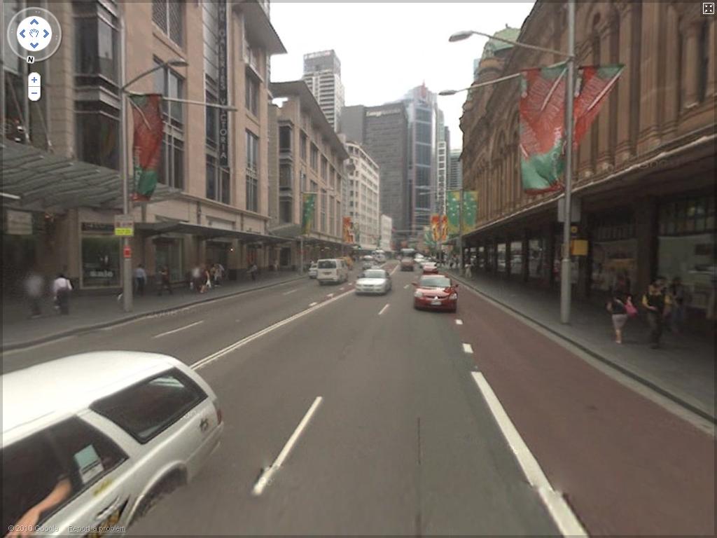
The ABC reports that Council is considering restricting vehicle access to George Street between Bathurst and Market Streets to just taxis and buses, rolling out a 40kph speed limit throughout the City. These are part of the recommendations of Gehl Architects which recommended a more holistic mindset of traffic and public space planning that looks after pedestrians and cyclists and improves the visual amenity of the City. Anyone who has walked up George Street from would agree with that. This shot from Google Streetview of George St shows why it would not win any awards for people friendly design.
I look forward to doing a tour of these projects in my next visit to Sydney.

Monday, April 5, 2010

Buffered bike lanes

Check out this fantastic video produced to educate the public about Portland, Oregon's installation of buffered bike lanes, something used quite extensively in New York (thanks to Peter Berkeley for sharing this link on Facebook).

On the Right Track from Mayor Sam Adams on Vimeo.


Here is a picture of a buffered bike lane in New York showing what it should not be used for. Note the potholes and drainage grate - they didn't get everything right.

What I find interesting in the video is the bridge in the background as Mayor Adams talks. It would appear to be a vehicle bridge that has one lane used by cyclists and pedestrians but I see no marking on the road to delineate this. I Googled and found a Streetfilms video on the Bridge - it is Hawthorne Bridge. It is clear in the video that it does have a kerb between the cars and bikes but interestingly no railing. Considering the obvious capacity issues on the ped and cycle section this seems a bit risky.

The bridge carries 7,200 cyclists per day which is 20% of the traffic on the bridge and it would appear that there are many pedestrians on the bridge too. Any conflict between cyclists or with pedestrians could catapult a cyclist straight into traffic.

Interesting fact I gleaned from the Streetfilms blog is that the number of cycle commuters in Portland has increased 600% in the last 15 years. If you build it, they will come (as said in the video)


Monday, February 22, 2010

Weekend training cycle

The Saturday morning training ride just got a little safer in Sydney when Kingston Council approved a 12 month trial of no-standing restrictions on one of the most popular cycling circuits on Saturday mornings. An article in The Age gives the details.

The media has been full of articles recently that accuse cyclists of being a lawless bunch. It is good to hear of measures being taken to make the sports cyclists lot a bit safer. Creating safe sports cycling routes on weekends would be an excellent initiative to reduce the risk.

The city of Durban in South Africa reserves one lane of the main arterial into the city from the north (NMR Avenue) for cyclists on weekends. It is a popular training route running parallel to the beach and has had several deaths.

In 2009 New York City closed city streets on three consecutive Saturday mornings and gave them to cyclists, joggers and impromptu markets. It was called Summer Streets and was a huge success. They are doing it again in 2010 because of the popularity. Wouldn't it be great to try something like this in Brisbane as part of Bike Week?

Monday, February 15, 2010

Swanston Street redevelopment

I posted previously about how the Melbourne public supports a car free Swanston Street. The plans remove car parking and give cyclists a 2 meter wide bike lane next to the trams in both directions. The redevelopment will be completed by 2013 costing $25.6 million according to an article in The Age. The Council's media release says that the redevelopment of Swanston Street will have:
  • A 24-hour ban on all cars (excluding taxis and authorised vehicles) to be implemented during 2010
  • Taxis to be banned from mid-2012
  • Four new public spaces with disability-compliant tram stops
  • Tram tracks lowered and the bluestone and granite paving extended to the platform edge
  • Two metre wide bike lanes – road rules will apply, cyclists must give way to tram passengers
  • Service and delivery vehicles at restricted times in limited sections of the street
  • New and consistent lighting, additional trees, florals, artworks and public seating installed along the street
  • Additional pavement-based activity including outdoor cafes and innovative retail encouraged
  • It remain Melbourne’s premier civic parade street.
This is a big win for pedestrians and cyclists although the shared space for cyclists and tram passengers at the stops is likely to be a major conflict point and will need to be watched. Pedestrians are already used to keeping an eye out for cars but once they are removed from the street will they remember to look out for cyclists before crossing?

The proposal was to be presented to Council on 2 February but no news yet as to decisions. What is interesting about this is the Lord Mayor's admission that his original views on returning cars to Swanston Street were wrong. He calls it his 'road to Damascus' where he 'saw the light'. Part of his conversion could be thanks to meeting New York's Mayor Bloomberg and seeing how he has given some of the busiest intersections in New York to pedestrians and cyclists and in doing so reduced congestion. Paul Steely White commented that New York's example can convince other cities to look after pedestrians and cyclists. This proves him right.

From a visit in 2008 I would say that cyclists and pedestrians on St Kilda Road around Flinders Street Station would welcome a bit more space at the expense of cars. Bicycle Victoria confirms that this is one of the most popular routes and dangerous spots for cyclists in the city.

Sunday, February 7, 2010

Bribane bike hire

Brisbane has called for tenders for the construction of the first 150 bicycle hire parking stations as reported in the Brisbane Times. Councillor Sutton has a valid question as to where cyclists will be able to ride. The paucity of safe cycle facilities in the CBD and Fortitude Valley is a major deterrent to potential cyclists, not to mention the need to wear a helmet.

There is huge potential for providing cycleways similar to the one in George Street on several of our city streets. Elizabeth Street and the lower end of Queen Street would make a great link across the CBD, a safe shortcut across the city. Linking to the pathways along the river would need some clever planning.
Linking the new cycle centre in Roma Street to Albert Street through the Mall would be good but the number of pedestrians would make it difficult to safely cycle through the mall. The Malls Act prevents cyclists using this section - a huge pity. The taxi parking would need to be moved to make this possible.
Continuing the cycleway along George Street would be fantastic but would need some clever traffic management and the poor taxis will get moved on again.

These are just idle ramblings on a Sunday afternoon. Anyone else out there with dreams for a network of cycleways through the city?


Saturday, January 2, 2010

On-road cycle lanes

I was down in Yamba for a week over Christmas and was interested by the on-road cycle facilities provided in the area. Instead of having 1.5m wide cycle lanes on each side of the road a 3m wide bi-directional cycle lane was provided on one side of the road. The roads were all rural roads serving small seaside holiday towns and have traffic volumes (I would suspect) and speeds of 80km/h.

This type of facility is not in the Austroads guideline and is a hybrid between a bicycle path and an on-road cycle lane. Although there may be issues of safety for cyclists travelling in the direction opposite to the adjacent traffic stream, there may be advantages for routes that have large numbers of sports cyclists. These cyclists tend to enjoy riding abreast or in groups and a 3m wide lane serves them far better than a 1.5m lane. if cyclists come in the opposite direction there may be safety issues if there is heavy traffic but I assume the local road safety people would work with local cycle groups to raise awareness of the etiquette of using these facilities.

The major advantage of a facility like this is that it may be cheaper to construct to retrofit cycle lanes on an existing road without paved shoulders. The tricky part is how to deal with cyclists at cross streets and at the end of the route if cyclists are accommodated in traditional cycle lanes on both sides of the road. Drivers at cross streets would not expect cyclists on the wrong side of the road but sports cyclists would prefer to stay on-road. It would be interesting to know the safety performance of these facilities.

In this example they took the cyclists off-road at the intersections and they crossed at a bent-out crossing. Although not the most convenient arrangement for cyclists I saw two cyclists use it. At the end of the route a pedestrian refuge and appropriate signage was provided were cyclists exited the facility on-road onto a low speed and traffic volume residential street where no pathways or cycle lanes were provided.
Posted by Picasa

Wednesday, December 9, 2009

Kurilpa Bridge comments

Walking over the Kurilpa Bridge on the way to the PBT end of year function we all discussed the great and problematic elements in the design for pedestrians and cyclists. Much like the Goodwill bridge, the bridge operates as a shared pathway with recommendation that cyclists keep right and pedestrians keep left. This works well and reduces the likelihood of cyclists becoming aggressive towards pedestrians being in 'their area' as happens where they are separated.

Instead of using painted lines down the centre of the bridge to separate the directions of travel the architects used different shades of concrete. This looks good, works well and is low maintenance. The photo does not show this as clearly as in real life.
The use of separated bi-directional cycle lanes along one-way Tank Street and George Street is excellent. What is odd though is that a 0.5 m wide raised kerb is provided on Tank Street where the traffic speeds and volumes are low, but a small removable barrier was used on George Street where traffic speeds and volumes are high. This results in wasted space on Tank Street where additional footpath width would have been beneficial.
As can be seen in the photos above and below there is a lot of pedestrian movement across Tank Street. Unfortunately there is no provision for a pedestrian crossing point between the bridge and the intersection with George Street. The traffic speeds and volumes are low but this arrangement is not ideal. Pedestrians tend to treat the area as a shared zone and it would have been preferable if the area was designed as a shared zone.
As can be seen above there is no pedestrian pathway for people wanting to walk back towards North Quay and so people walk through the flower beds.
There is a very odd arrangement for cyclists travelling down George Street that want to access Tank Street. According to this sign they need to ride on the footpath to cross at the lights. Considering the volume of pedestrian traffic along George Street this is impossible. It is also illogical for cyclists and all stay on the pathway and turn at the lights. The location of the sign is also unfortunate since it has been placed in the path of cyclists who would supposedly use the turning facility. The height of the sign also makes it invisible to cyclists and pedestrians.

A strange raised area is placed on the cycle path at the entrance to Tank Street. It is unclear what the intention of this is. It cannot be meant to slow down cyclists because it is barely noticeable on a bicycle. It is not meant to indicate a shared zone with pedestrians because the pedestrian crossing is ahead of it. Unfortunately the location of the ramp is just where cyclists need to stop to press the crossing button and makes it awkward to stop on an incline and press the button.
The pathway stops at Turbot Street where it quite elegantly funnels cyclists down to the King George Square Cycle Centre. Cyclists wanting to travel further south into the city are unfortunately left stranded on little Roma Street with no clear route south.

The heavy volume of traffic turning from George Street into Turbot Street currently constrains the possibility of extending the pathway further south along George Street. It is unfortunate though that the option to extend this further some time in the future was made difficult by relocating the traffic signal to the new kerb line. If the traffic signal had been left where it was the cost of extending the bike path down George Street in the future could have been significantly reduced. In planning for this type of facility we need to ensure that we allow for the easy expansion of the system in the future when the current traffic constraints may be changed.

The discussion of the Kurilpa side of the bridge found far fewer issues. The limited space and height of the bridge meant that the bridge makes a leisurely spiral down to the ground. Although very elegantly done it does make for a less direct pedestrian route. Providing the option of stairs could have provided a slightly more direct route for pedestrians but would probably have destroyed the elegant lines of the bridge.

The entrance to the bridge is narrowed by a low wall in the right of the photo above. Although not a major issue with the current volume of pedestrians and cyclists it may cause a bottleneck as volumes increase.

Sunday, December 6, 2009

Infrastructure safety

Michael Langdon brought to my attention an interesting literature review on the impact of infrastructure on bicycle injuries and crashes. The paper looked at safety at intersections and between intersections worldwide. The paper provides a useful overview of international research into cyclists safety with an interesting overview of the research reviewed.

The majority of the literature on intersections dealt with roundabouts. As would be expected the research found that multi-lane roundabouts are hazardous to cyclists. Separating cyclists from traffic at roundabouts, either through lanes or separate paths, improved the safety of roundabouts for cyclists.

The research shows that the most hazardous place for cyclists is on the footpath. This would seem counter-intuitive to most parents who usually advise their children to use the footpath. Unfortunately the paper does not go into this in more detail but it does indicate that much of the risk is due to cyclists entering intersections and crossing driveways in the opposite direction to traffic.

The research shows that the safest place for a cyclists is on a purpose-built cycle facility (cycle route, cycle lanes, cycle paths etc). Cycling on road was found to be less dangerous than cycling on the footpath with pedestrians. There are several Internet articles that discuss this subject including this one by Ken Kifer and they all agree: footpaths are dangerous places to cycle.

From this it is clear, providing a cycle lane on a road may be safer than providing a wide footpath. If there is a need for cyclists to be accommodated off-road it is essential that a purpose built facility is provided that adequately addresses safety for cyclists in the design, especially at intersections and driveways. Just widening the footpath is likely to increase the risk to cyclists unless the major areas of risk, at intersections and driveways, is not adequately addressed.