Showing posts with label safety. Show all posts

Friday, February 10, 2017

Raised priority crossings

Priority crossings of side streets are essential for off-road cycle tracks along arterial roads. Without the priority for cyclists the traffic on the minor side streets impact significantly on the safety and delay for cyclists using the cycle track. More confident cyclists will tend to ride on road and avoid using the cycle track, and all other cyclists risk their safety every time they have to cross the side streets.

The Cycle Track guideline (Technical Note TN128) issued by the Department of Transport and Main Roads gives good guidance on priority crossings for cycle tracks. Here are some examples I have seen delivered around the state.
 Brisbane Road on the Sunshine Coast

Entrance to theme parks and studios off Entertainment Drive, Gold Coast (photo from Google StreetView) - not the raised crossing on the slip lane.
Brassal Bikeway in Ipswich.

Brisbane has multiple locations where priority crossings are required on V1 Veloway. My pet hates are:
  • along O'Keefe Street with the crossing of Carl Street (Council did a half hearted upgrade in 2016 that did not address the issue at all)
  • along Bapaume Road and Birdwood Road
Stage E of the Veloway upgrade will hopefully provide a priority route for cyclists through this dangerous section of the V1. But unfortunately it may not address the issue for school kids cycling to Holland Park High which is just off the V1 along Bapaume Road. This is a personal issue for me as my daughter has just started high school there and our house is ideally located for her to use the V1 to cycle to school. However the multiple crossings of slip lanes, side roads and driveways make me very nervous for her safety.

Hopefully the upgrade to the V1 will also consider the needs of school kids needing to access Holland Park High. The upgrade does not appear to be funded yet so I dont know if it will get upgraded soon enough for my kids to use it to get to school. An interim intervention to improve this section would definately be welcome for commuters and school children using this dangerouse section of the V1. I have some ideas for improvements, if anyone would be interested.

Friday, July 10, 2015

Making walking and cycling safer

The European Transport Safety Council has recently released an interesting report called Making Walking and Cycling of Europe's Roads Safer. It makes for interesting reading. The variation in safety is significant across Europe with countries like Romania and Latvia having average annual pedestrian deaths over 7 times those of the best performers like the Netherlands, Norway and Sweden.

There are some strange statistics. Such as the gender of pedestrians killed on the roads. Why is there a greater proportion of men than women pedestrians killed in the UK, while Switzerland has roughly even number of male and female pedestrians killed over the last three years.

The breakdown in cyclist deaths by age category is interesting. Generally older people appear to be more at risk than younger people. Since the statistics are based on deaths per population the figures are skewed to show poor performance in countries with large numbers of people cycling (like the Netherlands).


What is interesting is the discussion on what is needed to make roads in Europe safer for pedestrians and cyclists. The interventions are obvious:

  • improve urban road design characteristics to be safer for cycling and walking - it will also help address congestion
  • reduce traffic speeds to 30km/h on residential roads and those in business districts
  • change the design of cars and trucks to reduce the risk if pedestrians and cyclists are hit by a car 
  • Change truck design to improve visibility of cyclists
  • have automatic/passive measures to reduce the risk of driver inattention 
  • behavioural changes for cyclists and pedestrians to reduce risk


Thursday, June 18, 2015

Personal safety

A while back I visited a friend who teaches underprivileged children in Phnom-Pehn, Cambodia. If you have visited Cambodia you will know the chaos on the roads. Pedestrians, vendor carts, bicycles, motorbikes galore and motor cars, buses and trucks compete for space in a seemingly lawless free-for-all on the road and footpath.


When our friend first moved to Cambodia several years ago she got around by bicycle because she could not afford a car. I asked her about how safe she felt cycling in the chaos. Interestingly she didn't talk about road safety, she spoke of her fears for her personal safety when cycling at night.

As soon as she could scrape together enough money she got herself a car so that she could feel safe leaving home after dark.  Having a car made life far more expensive and difficult. Finding parking on the street she lived in was impossible and caused huge conflict with her neighbours. Traffic jams are a continual frustration and her commute by car often takes longer and is less reliable than cycling was. The cost of running a car is more than she can really afford. But the peace of mind afforded to her of being cocooned in her little car, protected from predators made the pain and frustration of driving a car worthwhile. 


This got me thinking about how perceptions of personal safety/security can influence ones choice of mode. Here in Brisbane the threat of muggers, rapists and human traffickers is comparatively zero, yet for a large portion of the population (as much as 50%?) it can have a major influence on their choice of mode or route. 

A few years back Gayle (my wife) was working a late shift at a business in the Valley. Because of the issues of finding parking she decided to try cycling to work. Although the cycle network into the Valley is not great she found the afternoon cycle into work quite pleasant. However at around 10pm I got a rather concerned phone call from Gayle. She had successfully cycled out of the city on the bikeway but now found herself just south of Buranda where the bikeway goes along the creek corridor. This was before lights were installed on this section and she did not feel safe cycling through deserted parklands. She felt far safer cycling on road the rest of the way because the perceived threat to her personal safety of cycling through a dark and deserted park was greater than the road safety risk of sharing a road with no cycle lanes. 

A friend cycles to work at the PA hospital. Despite having access to a bikeway just down the road she cycles the first section on road because she does not feel safe riding through Tooheys forest on her own at any time of the day. 

Because of this it is always important to remember to consider personal safety/security when planning and designing cycle networks. The CPTED guidelines are useful as a tool for informing route option assessment and design. However it can also sometimes be a hindrance to delivering some excellent network outcomes due to concerns about sending cyclists down hidden corridors behind noise barriers and back fences of properties, or through woodland areas. Even with lighting these places can seem very threatening at night, particularly in certain areas or on parts of the network where there are few users. 


I think however that CPTED issues should rarely be a reason not to deliver an off-road cycle link that has clear network benefit. A route identified through a CPTED assessment as having a risk to personal security should have appropriate design treatments to reduce the perceived and actual risk. And if possible it would also be good to provide a on-road alternative to allow for greater route choice. That way cyclists can make a choice of route based on the perceived risk. By having an integrated network of on-road and off-road cycle routes we can serve a larger cross section of user needs, and hence make cycling a more attractive proposition for a greater proportion of the population. 

Thursday, March 12, 2015

Desire lines


No, not the lines of people trying to pay for their shopping. Desire lines are lines drawn on a map that represent where people desire to go. When planning and designing infrastructure for active transport (especially pedestrians), desire lines are an essential indicator of how people will want to use the facility. This is because it may take extra effort to deviate off the route that gives you the shortest path to your destination. The less mechanical assistance you have, the more important the shortest path is to route choice.

It is important to realise that the shortest path is not necessarily the route that has the shortest distance. It tends to be the route that appears to be the most direct path to the destination from a point of decision. For the pedestrian this is usually the route that follows the 'line of sight' - a path that most closely matches a straight line route from where you stand to where you want to go.

When planning and designing active infrastructure you ignore desire lines at your peril. Here are two examples. 

The first is an old one that I see every day I ride to work. It is the link across Little Dock Street between the Kangaroo Point Bikeway and Vulture Street. This link is restricted as I bicycle-only connection. The planning intent was that pedestrians wanting to access Vulture Street would cross Little Dock Street at the Goodwill Bridge and use the bougainvillea pathway. Cyclists would use the Kangaroo Point Bikeway and exclusively use the link across Little Dock Street. sort of like the illustration below. The Kangaroo Point Bikeway and the pathway alongside it were designed with fences, kerbs and signs to ensure people stick to this arrangement.

All very nice and neat. However, this arrangement neglects to recognise that when walking people make their routing choices based primarily on desire lines in order to expend the least effort in reaching their destination. The infrastructure and regulation are only considered where they physically prevent a movement, or when the 'self-preservation' instinct overrides the 'least-effort' instinct.

The desire-lines for pedestrians between the Goodwill Bridge and Vulture Street can be shown as below. In addition to this major desire line there is also a minor pedestrian desire line between Vulture Street and the pathway going east along Little Dock Street.
The resulting pedestrian movements result in significant conflict between pedestrians and cyclists along a very narrow section of separated pathway (only 2m wide cycleway).
For the most part pedestrians recognise that they are crossing the bikeway and they are careful to not get in the way. They check before they cross and keep their eye out to avoid conflict, as can be seen in the picture below. Note the pedestrian in the background is also keeping an eye out to avoid conflicts on the narrow path.
In fact it is such a well-worn route that you can see the path through the vegetation that pedestrians take to avoid being in the way of cyclists.

But often this does not happen and conflict erupts. I almost witnessed a fist fight recently where a rather muscular pedestrian who had been walking in the middle of the bikeway shoved a cyclist when he tried to get past after ringing his bell. Usually this sort of conflict just results in some rude words being exchanged as the cyclist and pedestrian exchange their feelings of mutual dislike for each other. That time (and I am sure there have been many others) it could have ended tragically.

The solution to this is relatively simple, but will cost some money. What is needed is to provide sufficient space for both pedestrians and cyclists to make the link between the Kangaroo Point Bikeway and Vulture Street. More fences and signs will not solve the problem, it will just make it more frustrating for all users.

The next example is a more recent one - the landing of the Kurilpa Bridge on Tank Street. When designing this landing the engineers had great difficulty fitting in all the pedestrian, cyclist and vehicle movements. The complicating factor was the driveway off Tank Street for access to a parking garage. This wide driveway was adjacent to where the bridge landed and spills its load of pedestrians and cyclists. The designers came to the conclusion that the driveway entry and exit meant it was not possible to provide sufficient space to store pedestrians wanting to cross Tank Street. The large number of vehicles using Tank Street to access parking garages would have been too severely delayed by creating a shared zone for pedestrians and vehicles.

So the solution delivered was to prevent pedestrians and cyclists from crossing Tank Street where the bridge landed. A wall was constructed to prevent this movement and gardens planted to make it clear that pedestrians should not cross here. Fortunately as a compromise a speed hump was included on Tank Street to slow drivers down as they approached the parking lot driveway.

Unfortunately the pesky pedestrians had not studied engineering and they refused to comply.
 They just didn't seem to realise that this was not an approved maneuver.

 Within no time they had worn a path through the landscaping that was intended to prevent them from crossing.

Unfortunately the designers ignored the very obvious desire lines. The approved place to cross Tank Street was determined to be at North Quay and George Street (as below). That would ensure that any conflicts that would occur could be controlled.
What this design ignored was the very strong pedestrian desire lines between the coffee shops (and parking garage) on the north of Tank Street, and the offices and bridge on the south. It also ignored the fact that the proposed path between North Quay and the Kurilpa Bridge or south Tank Street was not at all obvious and was not on the pedestrian (and cyclist) desire line.
 So of course this resulted in pedestrians (and some cyclists) making 'unsafe' maneuvers.
 Thankfully a solution was retrofitted that better provides for pedestrian and cyclist desire lines.

It is unfortunate that desire lines were ignored in the initial design, as I am sure that a more elegant solution could have been found to this problem.

Friday, January 23, 2015

Off-road cycle paths along roads

Separated cycleways are becoming increasingly popular worldwide. I have posted previously about the latest guidelines from TMR for separated cycleways.

But the concept of separating cyclists from cars in the road corridor is not new. Previously the standard was to provide wider footpaths that allowed sharing of the facility by pedestrians and cyclists. I recently saw an example of one of these on Cotlew Street on the Gold Coast.
 This included separation between cyclists and pedestrians.
 Unfortunately the pathway is only a total width of around 2.5m. So with separation it provides a footpath and a cycle path that are both too narrow. If the cycle path was only on one direction that would be better, but there was no corresponding facility on the other side of the road. one-way pathways are also unlikely to work as cyclists are unlikely to cross the road to access the pathway on the other side.
The pathway also crosses several side streets with no priority given to cyclists over the traffic on the side roads. This solution is inconvenient and slow for cyclists and not very safe.

To make matters worse, the facility was not part of a continuous off-road cycle route.

Can it be retrofitted to be a viable separated cycleway? If it was part of a broader network of off-road cycle paths, it may be worthwhile to investing in:

  • removing the separation between pedestrians and cyclists to provide a 3m wide shared path
  • providing priority to the pathway across the side streets.
I am sure a lot of our older suburban cycle paths along modern arterial road corridors could benefit from a similar investment to reduce delay to cyclists and improve safety by increasing their priority through intersecting streets.

Thursday, July 31, 2014

How child friendly are our cities

The ABC started a brilliant series called Life at 9. The first episode looked at the question of creativity. They looked at the role of independence and how nine year olds of today have hardly any independence. In comparison, previous generations gave a nine year old a lot more autonomy and they were expected to take on more responsibility. This is essential for the  development of a child's creativity by instilling self confidence in their own ability to solve problems as independent entities from their parents.

In that first episode they did a little test of independence - something that was common in previous generations. They asked the 10 children participating in the study to walk from their home to the closest corner store to buy an ice lolly. Only two of these children could successfully complete the task. The rest couldn't because of:

  • fear of the unknown
  • traffic preventing them from crossing roads
  • the lack of any corner store within walking distance
If you missed it you can watch on Iview.

It really got me thinking about how child-friendly our suburbs are. This month we passed a milestone with our kids. We asked our nine and seven year old daughters to walk to the corner store on their own to buy milk and eggs. We are fortunate in that there are two corner shops within walking distance. The one is on the other side of a busy road that would be difficult to cross. The other can be reached with only crossing minor side streets.

The next level of independence would be for them to walk to school on their own. There is just one road crossing an the route that is a cause for concern. Traffic flies around the corner and it is a hazard for children to cross. In Tokyo parents don't accompany their children on the walk to school. From prep the children walk themselves to school. Would this be possible in our Australian cities?

A nine year old may be a good auditor of the walkability of our neighbourhoods. If a young child can safely navigate their way on foot from home to the corner store or school I think it would be safe to say that we have a walkable neighbourhood. When designing our urban roads we should be designing with the needs of the local residents in mind (especially children), not the need to limit delay to the traffic passing through the suburbs.

Monday, April 28, 2014

Sight distance

Recently an apartment complex Did a refurbishment. They are adjacent to the V1 Bikeway close to O'Keefe Street, Buranda. As part of their refurbishment they installed a new fence on their property.Due to its height and proximity to the bikeway the fence restricts sight distances for out-bound cyclists and persons entering the bikeway. 
 These photos don't really show how severe the impact is. On the first day after the fence was installed I almost ran over a pedestrian who was trying to cross the bikeway. Neither of us could see each other till the last moment. Luckily he managed to quickly step back in time. If it was a mother with a pram I think I would most likely have crashed into the pram.

Council cannot do anything about this as the fence is perfectly legal. It is within the property and there are no restrictions on the property that would prevent them from installing this fence.

Austroads Guidelines (Part 6A: Pedestrian and Cyclist Paths) recommends against locating paths adjacent to property boundaries for exactly this reason, and Section 7.8 has recommended clearances for curves to get safe sight distances. This bit of bikeway is squeezed between the property boundary and a retaining wall, so not much opportunity to get adequate separation. It would have been good though to get some sort of restriction placed on the height of boundary fences for the property to avoid this type of hazard.

When planning new shared paths that are adjacent to property boundaries it would be good for planners and designers to keep this example in mind, and put in place appropriate measures to prevent this from happening.

Thursday, January 30, 2014

Cyclists needs

A presentation by John Offer (from the City of Stirling) to the WA Cycling Safety Forum has some interesting approaches to the needs of users and appropriate treatments to cater for them (follow the link to see it). In Western Australia cyclists older than 12 are not allowed on the footpath. The intent of this is to minimise conflict between pedestrians and cyclists. But John rightly points out that many adult cyclists have very similar riding styles and confidence/skill levels as younger cyclists. They are therefore proposing to allow adults to cycle on footpaths as long as they are slow. To reduce the speed of cyclists on pathways they are trialing a 'Stirling Gate' - photo below.


It would be interesting to find out how that has performed.

With regards the types of cyclists he uses three groups - the 12-year old cyclist, the casual adult or POBSO (don't know what that means), and the Adult experienced cyclist group or commuter. My personal preference is the classification I developed after reviewing several alternatives (including 'The Principles of Cyclist Network Planning’ Land Transport NZ). 

Type of cyclist
Description
Beginner
Beginner cyclists include young children and novice cyclists. They can be unpredictable and prefer full separation from other traffic, particularly when travelling along busy roads.
Trips by beginner cyclists are commonly to school and shops and for pleasure near their homes or in recreation areas.
Beginner cyclists often find it difficult interacting safely with vehicle traffic when not on traffic-calmed local streets. They prefer grade-separation or signal controlled intersections when crossing busy roads.
Cautious
Cautious cyclists include those with basic competence and more experienced cyclists who are risk averse. Cautious cyclists prefer separated cycle facilities but can ride on quiet two-lane roads, can manoeuvre past parked cars, and merge across and turn right from beside the centre line. They can cope with simple traffic signals and single-lane roundabouts that are designed for slow through traffic.
When required to travel on busy roads, cautious cyclists prefer cycle lanes and facilities at intersections. They are not well equipped to interact with faster traffic, multi-lane roads and multi-lane roundabouts. They usually lack the confidence to defend a lane where the lanes are too narrow to share.
Cautious cyclists are willing to use alternative longer routes in order to avoid situations perceived as high risk.
Confident
Experienced cyclists interact assertively with traffic. They do not require specific cycle facilities, only the space on the road when in amongst faster/busier traffic situations. Experienced cyclists will defend a lane where there is not enough room, judge the merge across faster multi-lane traffic, use multi-lane roundabouts in most cases (though apprehensively), and will not usually divert to a cycle path unless it provides a higher level of service than riding on-road.

I like this classification because it does not confuse the trip purpose, age or experience of the rider with their needs. Any classification that has a category 'commuter' does not recognise that commuters can range from novice cyclists to confident cyclists and the network needs to account for the needs of all to maximise the potential to promote cycling.

Tuesday, January 28, 2014

Crash data available on line

Government's open data policy is making access to crash data far easier. Have a look at the website to see what else is or will soon be available from the Department of Transport and other government agencies. I played with the crash data and was quite horrified to see the carnage that occurs on our road network.

There is lots of data on crashes involving pedestrians and cyclists and any number of different ways to cut it. Here is a graph I put together summarising the fatalities and hospitalisations of cyclists over the last 10 years split by TMR regions.

As you would expect, the Metropolitan Region has the highest number of fatalities and hospitalisations. What would be interesting to cross-correlate this data with population and/or cycling activity levels.

The data from TMR includes the traffic census on state controlled roads for 2012 but unfortunately does not include the count data for bicycles that TMR previously placed on the 131940 web site. It would be great if the historical count data from their cycle monitoring stations could also be released as it was previously.

Wednesday, March 14, 2012

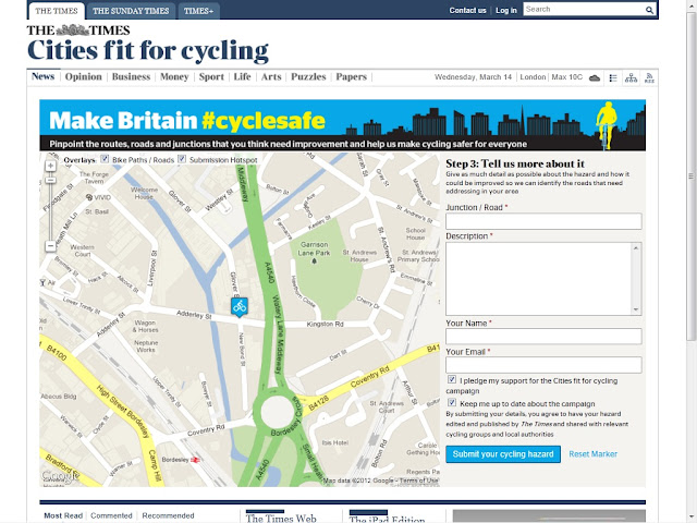
Cities Fit for Cycling

The Times in London has launched a campaign to map the areas of London that require improvement for cycling. In a recent post I mentioned a similar bit of work being done by the University of NSW.

It is a fantastic tool that uses the power of the internet to get a whole lot of information relatively cheeply. Unfortunately it does not make the information available to the general public to see what hazards are being reported by others. They may have done that to avoid people copying other people's posts - they hope to get actual users instead of just web-surfers with time on their hands.

By getting all cyclists to become your auditors of safety it is possible to build up a system to prioritise issues in the network. The system will prioritise safety or maintenance issues that affect the most people. Unfortunately it may not prioritise issues that have the most risk due to the fact that most cyclists are risk-averse and will therefore not use routes that are very risky.

Saturday, February 25, 2012

Mobility scooters

With the population in Australia aging rapidly there is an increasing use of mobility scooters to get around. The Sydney Morning Herald recently had an article on the dangers of these scooters. Most of the 700 hospitalisations that occurred last year happened on the roads, with falls at home being next dangerous. An average of 6 people per year die from their injuries, the majority due to head injuries.

There are stories of confused pensioners trundling down motorways on their scooters, but most of the risk to users is just navigating pathways around residential areas. Most of the pathways in older residential areas are only 1.2m wide, if there at all. I have seen mobility scooters being driven down the shoulder of busy arterial roads despite wide pathways because the ramps at intersecting roads are too steep or awkward to navigate.

When planning for active transport networks and designing facilities we are required to provide for mobility impaired users, but what do we do about all those areas where the existing facilities cannot be used by mobility scooters and wheelchairs? Council has recently been replacing pathways and ramps in my neighbourhood but most are still unusable for mobility scooters and wheelchairs after being replaced.

Thursday, June 16, 2011

Compromise

Something controversial to ponder... Austroads guidelines recommend the minimum standard for an off-road commuter shared path be 2.5m wide, and a recreational path be 3m wide. Ideally active transport planners and activists would like to see all pathways constructed greater than 3m wide to provide the highest standard of facility to ensure safety and comfort of all users.

In the fiscally constrained environment we find ourselves in at the moment, I have doubts whether this may always be the best approach.

My commute along the old SE Freeway Bikeway (and several other older shared paths) has long sections of 2m wide shared pathway. Although the risk of conflicts with pedestrians and other cyclists is high the narrow shared pathway has performed well over the last 20 or so years.

If it had been constructed 3m wide (as it now is being upgraded to) but had only reached Greenslopes due to budget constraints, would it have been as effective at encouraging cycling and the recreational use of the green corridors along the freeway and creeks? No it would not as the catchment of the bikeway would have been greatly reduced.

So the question is, Do we fight for wider or longer cycle facilities? If there is an existing 2m wide shared path that currently gets used by 2 dog walkers and 10 cyclists in the peak hour, do we really need to widen it to 3m to comply with Austroads standards - or would it be better to extend the path to increase the catchment. I would choose the latter as it would have a greater positive impact in increasing use of the shared path and this would justify upgrading the pathway to a wider standard once demand warrants it.

It is however vital that we protect our off-road corridors to allow for future widening when demand warrants it. We have this approach when we plan roads and we must do the same for our cycle facilities. Not all shared paths will be 6m wide facilities like the Bicentenial Bikeway - not all roads will be motorways. But those with potential for high use must have sufficient corridor width to allow for future widening to an appropriate standard.

Can one use the same argument for on-road cycling. Brisbane City Council has mostly adopted the approach of using Bicycle Awareness Zones (BAZ) instead of Sydney New York or Melbourne's decision to take away space from traffic or parking to develop a network of separated bike lanes.

I would say that the same logic is not applicable to on-road cycling. The reason is because the severity of the consequence of a crash are so far greater for cyclists on-road than they are for cyclists on a shared path. A conflict on an off-road path is most likely to result in some bruising (of body and pride). A conflict on the road is likely to result in a visit to the hospital or morgue. An extensive network of roads with orange BAZ symbols painted on the road will have a far lower impact in encouraging cycling in the CBD than a few well placed separated bike lanes would have.

This video on New York includes some interesting statements on how improved cycling facilities have increased the number of cyclists and reduced the number of injuries.

New York City Bike Wars

So while I would advise spending our limited budgets on longer rather than wider shared paths (unless demand warrants the wider path), I would advise more expensive higher standard on-road facilities instead of an extensive network of cheaper sub-standard on-road cycle facilities.

Saturday, May 14, 2011

The need for speed

I enjoy my 8km cycle commute to work and occasionally try beating my best time for the commute. But speed often gets me, and others, into trouble. The bikeway is a fantastic way to get to work but it can get a bit crowded. Since I cycle in from the south east most of the route has cyclists and pedestrians sharing the path. In some of these cyclists travelling at speed are a major hazard - to themselves, pedestrians and other cyclists. Sections like the Goodwill Bridge, Victoria Bridge, Southbank and the old Bicentennial Bikeway have so many cyclists, walkers and runners that things can get a little hair raising during peak commute times.

I sympathise with the idea of a pro-cycling Perth political to implement speed limits for cyclists as reported in this article. The problem is, they are not really practical. Cyclists are not legally required to have speedometers fitted so there is no way they can know whether they are travelling over the speed limit. I have not checked the road rules but I suspect that it would be impossible to fine a cyclist for speeding. It is more likely that they would be fined for reckless or dangerous cycling.

Speed only really is an issue where there is potential for conflict between pathway users travelling at different speeds. The risk of conflict is increased as the space per user decreases, and the speed differential of users increases. Which is why the guidelines recommend that pathway width increase on busy shared pathways, or users are provided with separated pathways where conflicts are high.

There may be a need for guidelines to recognise that the speed differential of cyclists is also a risk. Busy rural roads have passing lanes to allow fast cars to bypass caravans and slow trucks. For cyclists the equivalent would either be a wider cycleway (as recommended in the Cycling Super Highways) or providing both on-road and off-road options. The former may be preferable but the latter may be the pragmatic answer that is implementable.

A 3m wide shared path and 1.5m wide bike lanes is often far more palatable for roads engineers than a 6m wide shared pathway. But effectively cyclists have the same amount of space allocated to them. And by separating the shared pathway and cycle lanes there is potential that confident cyclists with a need for speed will choose the bike lanes while the slower cyclists and pedestrians share the pathway.

This is all conjecture as I have not seen any research on this. But something worth considering when deciding on the appropriate solution for a corridor.

Thursday, March 24, 2011

Do you feel safe

An recent article on a cyclist who got run over by a bus got me thinking about what risks there are in my cycle to work. The story was of a cyclist who got run over by a bus when they made an error and got launched over their handlebars into the path of an oncoming bus. Similar could happen to me on the Victoria Bridge if a passing car comes too close and clips my handlebar. I would be under an oncoming bus in no time.

Another high risk section of my ride is the steep, narrow and winding track that links the SE Bikeway to Lower River Terrace. Cyclists come down there fast, it is narrow and then most of us launch into Lower River Terrace at speed. I wonder how many crashes occur there without ever being reported.
The University of NSW is undertaking research into the safety of cycling by enrolling 2,000 cyclists to report near misses and crashes over a year. Read this article on the study. The Safer Cycling Study web site is here. There is no data available on their research to date and I look forward to seeing the results.

This is a truly excellent bit of research that needs to be replicated in every city as a permanent program. Anyone with experience in workplace health and safety knows that safety is best improved by reporting and addressing near-misses and risks. Responding to incidents means someone needs to get hurt before something gets done. By logging near misses or minor incidents from cyclists the city can develop a comprehensive risk map for cyclists and more reliably identify and prioritise cycling 'black spots'.

Any researchers out there interested in getting something like this started in Brisbane, Gold Coast or Sunshine Coast?

Saturday, January 22, 2011

Flood immunity


Over the past month Queensland has suffered massive floods and Victoria is now being inundated. As always happens when it rains, the bike paths were the first bit of transport infrastructure to go under. Guidelines advise a flood immunity immunity of 1 in 2 years for bike paths. This is most likely motivated by economic reasons rather than safety - but it is essential that safety be considered.

My local route to work is along a creek which doubles as a storm water drain. At some of the road underpasses it floods often. This is not too serious as there is a relatively simple and safe escape route/bypass that allows me to get past the flooded section.

The massive flood event like the one we just experienced has closed our major cycle routes into the city - not just for a few hours, but for weeks and some will be closed for months. The Bicentennial Bikeway is still closed a week after the floods. The floating walkway from New Farm to the Storey Bridge washed away and will take many months to replace. These routes are the active transport freeways into the city and carry around 10,000 pedestrians and cyclists a day. Where do these users go now that these routes are closed?
Many of the trips made on these routes are for fitness and recreation and will just not be made. But what about those commuting trips that still need to be made? On the Monday after the floods I ventured in to work by bicycle to see how things work. Unlike my local route home along the creek the alternative routes for these major cycle routes into the city are far from obvious. Many cyclists would see the alternative routes as rather hazardous and would probably choose not to cycle. It will be interesting to interrogate the data from count stations after the floods (hopefully some are working) to see how the floods have impacted on commuter cycling.

I believe this shows that we are too reliant on our fantastic off-road cycle routes into the city. There is a need to bolster our on-road cycle routes which can act as alternative routes during flooding or construction. They need to allow cyclists to safely bypass the closed section and they need to be legible. The cycle lanes on Grey Street provide an excellent bypass of Southbank and the southern portion of the Bicentennial Bikeway, but people need help to navigate through the alternative route.
Improved network legibility is not just about network resilience during unusual unplanned incidents (floods etc). It is vital during planned events that may close the normal route (festivals, construction, floods). Without this legibility the user (whether on a bicycle or on foot) is left wondering whether they should just risk wading through the flood waters because they see no alternative.

Wednesday, October 6, 2010

Melbourne's Albert Street seperated bike lanes

Bicycle Victoria reports on the separated kerbside bicycle lanes along Albert Street in Melbourne that opened in June to much controversy. The media, the RACV and even some cyclists labeled them as a waste of time and money and many drivers were unsure how to use them with reports of drivers parking in the bike lane during the off-peak, instead of in their parking lane. VicRoads have made improvements to the lane to make it more obvious how to use them, including making the bike lanes green paint and installing flexible guides to dissuade drivers from using the lane - as the picture below shows. It would appear from the picture though that drivers still have difficulty understanding as there appears to be a yellow car parked in the lane in the photo.

VicRoads recently released a road safety audit of the performance of the bicycle lanes. The audit notes that the treatment is unique in Melbourne (although common elsewhere in the world) and would therefore confuse drivers until they are used to it. The report notes some inherent road safety risks including drivers entering side streets and driveways not being aware of cyclists and the risk of passenger doors and pedestrians stepping into the lane (BV notes that only 10% of cars have passengers so the risk is far less than driver-side bicycle lanes). It does not come to any conclusion as to the safety of the treatment or any measures that could improve the safety.

Bicycle Victoria has published an overview of international practice in separated bicycle lanes that provides a useful scan of international practice in using these.

Wednesday, September 29, 2010

Bicycle Safety

In the Augusat 2010 issue of the Journal of the Australian College of Road Safety is a special issue dedicated to Bicycling Safety. They have these peer-reviewed papers on safety issues:
  • Crash prediction models and the factors that influence cycle safety
  • Cycling injuries in Australia: Road safety’s blind spot?
  • Child cyclist traffic casualties: The situation in South Australia
  • The effects of bicycle helmet legislation on cycling-related injury
  • Cyclist visibility at night
  • The role of traffic violations in police-reported bicycle crashes in Queensland
  • Painting a designated space: Cyclist and driver compliance at cycling infrastructure at intersections
They also have the following articles:
  • A note on the central stories of fatal and other cyclist accidents in Adelaide
  • Piloting a Safe Cycle education program
  • Encouraging safer cycling through the NSW BikePlan
  • Cycling safety in the Australian Capital Territory
  • Cycling safety in Victoria
  • The Australian Bicycle Council and the National Cycling Strategy
  • The Amy Gillett Foundation ‘A metre matters’ campaign and other initiatives
  • The politics of cycling and cycling advocacy
There is lots to read and I have just started but an interesting peer reviewed article is the one on crash prediction models. The graph showing the improved safety due to increased numbers of cyclists is quite well known.
The reduction in risk as length of cycle lane increases:
And the reduced risk as speeds reduce:
Kerbside parking is always a problem for cyclists. It is interesting though that low parking utilisation in the kerbside lane is more dangerous for cyclists than high parking use. This is likely due to the fact that cyclists use the empty lane and then need to enter traffic when there is a parked car. This increases the risk as drivers may not expect them.

Sunday, September 19, 2010

CityCycle dreaming

I dreamed the other night that I hired one a CityCycle bike to go to a lunch appointment in the West End. It was great except there was no parking when I got there. The restaurant had hidden the cycle racks under some tables. So How very disappointing. Lets hope that does not happen in reality. It would seem highly unlikely considering the number of docking stations being rolled out all over the city and West End. See the map here.

It is exciting seeing all the cycle hire stations getting the finishing touches around the city. I was so excited I asked our 'green team' at work whether the company were going to take out corporate membership of CityCycle. The response was disappointing, but not surprising - the health and safety policy would not allow it because the risks are just too high. Experienced cyclists are encouraged to use the scheme but the lack of safe cycling facilities in the CBD means the risk for inexperienced cyclists is too great.

I suspect many company health and safety committees will come to the same conclusion. It will take a lot to change the perception that cycling is dangerous. Interesting statistics from the Netherlands is that walking is actually more dangerous than cycling. The fatality rate for pedestrians is far higher (per billion kilometers travelled) than cycling is. And both are more dangerous than driving, being above the average for all modes. Here are the numbers for the years 1999-2003.

Pedestrians 32 deaths/billion km
Cyclists 14 deaths/billion km
Car drivers 4 deaths/billion km
All modes 6 deaths/billion km

From these statistics it would appear advisable for health and safety committeesto advise people against walking and cycling and encourage people to drive more. But public transport is even safer as these statistics from the UK show. Interesting to see how much safer it is for cyclists and pedestrians in the Netherlands.

Passenger death rates per billion passenger kilometres


1993 1997 2001 2002
Motorcycle 106.0 119.0 112.3 111.3
Walk 70.1 57.6 47.7 44.8
Bicycle 46.5 44.9 32.7 29.5
Car 3.2 3.1 2.9 2.8
Van 1.6 1.0 0.9 1.0


Bus or coach 0.7 0.3 0.2 0.4
Rail2 0.4 0.5 0.2 0.3
Water3 0.0 0.0 0.4 0.0
Air3 0.0 0.0 0.0 0.0

Thursday, July 1, 2010

Training ride curtailed

The Saturday morning no standing zone along Beach Road on trial by the Kingston Council is showing improvements in traffic flow and no significant parking issues, not to mention the huge improvement for the safety cyclists - as reported in The Age.

Despite this the neighbouring Bayside City Council is not interested in continuing this through their section of Beach Road as reported in the same article. Road cyclists are not that popular with some members of the general public (as can be seen by some of the comment at the end of this and other similar articles) but they are a large and growing fraternity. Ignoring their need for safety will have the result of increasing the death toll of cyclists on the road. Sad but true.

Monday, April 5, 2010

Buffered bike lanes

Check out this fantastic video produced to educate the public about Portland, Oregon's installation of buffered bike lanes, something used quite extensively in New York (thanks to Peter Berkeley for sharing this link on Facebook).

On the Right Track from Mayor Sam Adams on Vimeo.


Here is a picture of a buffered bike lane in New York showing what it should not be used for. Note the potholes and drainage grate - they didn't get everything right.

What I find interesting in the video is the bridge in the background as Mayor Adams talks. It would appear to be a vehicle bridge that has one lane used by cyclists and pedestrians but I see no marking on the road to delineate this. I Googled and found a Streetfilms video on the Bridge - it is Hawthorne Bridge. It is clear in the video that it does have a kerb between the cars and bikes but interestingly no railing. Considering the obvious capacity issues on the ped and cycle section this seems a bit risky.

The bridge carries 7,200 cyclists per day which is 20% of the traffic on the bridge and it would appear that there are many pedestrians on the bridge too. Any conflict between cyclists or with pedestrians could catapult a cyclist straight into traffic.

Interesting fact I gleaned from the Streetfilms blog is that the number of cycle commuters in Portland has increased 600% in the last 15 years. If you build it, they will come (as said in the video)